File:Barlow County.pdf
Size of this JPG preview of this PDF file: 530 × 599 pixels. Other resolution: 1,811 × 2,048 pixels.
Original file (2,866 × 3,241 pixels, file size: 2.14 MB, MIME type: application/pdf)
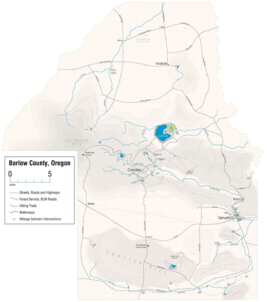
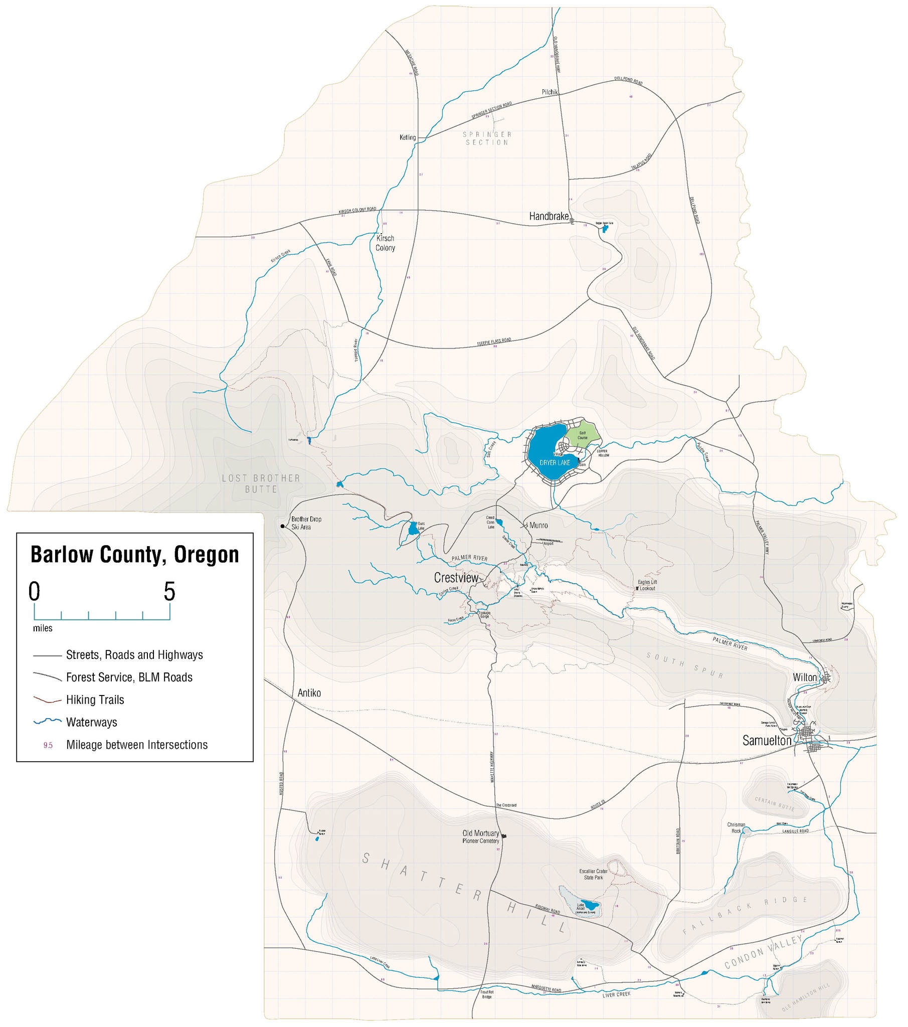
Map of Barlow County
File history
Click on a date/time to view the file as it appeared at that time.
| Date/Time | Thumbnail | Dimensions | User | Comment | |
|---|---|---|---|---|---|
| current | 15:58, 16 September 2019 |  | 2,866 × 3,241 (2.14 MB) | BCMystery (talk | contribs) | Additional minor refinements |
| 15:00, 16 September 2019 |  | 2,866 × 3,241 (2.05 MB) | BCMystery (talk | contribs) | Various visual refinements | |
| 12:06, 16 September 2019 | 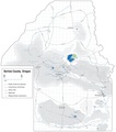 | 2,864 × 3,239 (2.54 MB) | BCMystery (talk | contribs) | Added Lake Ansel and other water features. | |
| 18:35, 25 August 2019 | 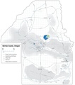 | 2,864 × 3,239 (2.49 MB) | BCMystery (talk | contribs) | Refined Wilton and various road | |
| 16:27, 8 May 2019 | 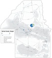 | 2,864 × 3,239 (2.45 MB) | BCMystery (talk | contribs) | Added Dellpond Road | |
| 17:57, 6 May 2019 |  | 2,864 × 3,239 (2.44 MB) | BCMystery (talk | contribs) | Added Jiggles | |
| 15:10, 19 April 2019 |  | 2,864 × 3,239 (2.44 MB) | BCMystery (talk | contribs) | Reduce Dryer Lake sprawl | |
| 19:57, 18 April 2019 | 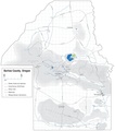 | 2,864 × 3,239 (2.42 MB) | BCMystery (talk | contribs) | Adjustment to Pilchik's location, moved further north | |
| 10:22, 11 April 2019 | 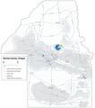 | 2,864 × 3,239 (2.41 MB) | BCMystery (talk | contribs) | Small adjustments to Dryer Lake Resort roads | |
| 12:08, 23 March 2019 |  | 2,864 × 3,239 (2.39 MB) | BCMystery (talk | contribs) | ||
| 09:46, 11 March 2019 | 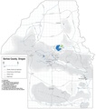 | 2,864 × 3,239 (2.38 MB) | BCMystery (talk | contribs) | Added Salvage Larry's Parts Yard | |
| 12:41, 30 January 2019 | 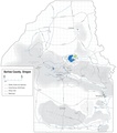 | 2,864 × 3,239 (2.36 MB) | BCMystery (talk | contribs) | Added fumaroles and additional trails/unimproved roads on Lost Brother | |
| 09:11, 12 January 2019 | 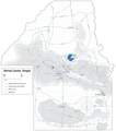 | 2,864 × 3,239 (2.29 MB) | BCMystery (talk | contribs) | Tweaks around Copper Baron Lake | |
| 09:48, 16 September 2018 |  | 2,864 × 3,239 (2.28 MB) | BCMystery (talk | contribs) | Add south county mileage. | |
| 13:16, 24 August 2018 | 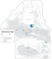 | 2,864 × 3,239 (2.28 MB) | BCMystery (talk | contribs) | Additional north county detail and mileage | |
| 12:13, 24 August 2018 | 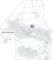 | 2,864 × 3,239 (2.27 MB) | BCMystery (talk | contribs) | Add towns, waterways, and major roads to the northern county | |
| 15:01, 4 August 2018 | 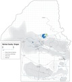 | 2,864 × 3,239 (2.15 MB) | BCMystery (talk | contribs) | Added area details specific to the story "Waldo's Gold." | |
| 12:20, 5 July 2018 | 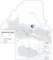 | 2,864 × 3,239 (2.13 MB) | BCMystery (talk | contribs) | Added Liver Creek irrigation reservoir. | |
| 15:36, 2 July 2018 | 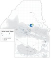 | 2,864 × 3,239 (2.11 MB) | BCMystery (talk | contribs) | Added more mileage indications for south county roads. | |
| 11:23, 2 July 2018 |  | 2,864 × 3,239 (2.1 MB) | BCMystery (talk | contribs) | Add mileage indications for some south county roads. | |
| 15:38, 22 June 2018 |  | 2,864 × 3,239 (2.07 MB) | BCMystery (talk | contribs) | Renamed McCarty Road to Ridgway Road and Mitchell Road to Marquette Road | |
| 12:35, 21 June 2018 |  | 2,864 × 3,239 (2.06 MB) | BCMystery (talk | contribs) | Small changes to south county roads and water courses. | |
| 14:58, 20 June 2018 | 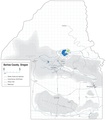 | 2,864 × 3,239 (2.06 MB) | BCMystery (talk | contribs) | Changed Condon Creek to Liver Creek, added Little Liver Creek and label for Condon Valley | |
| 10:28, 15 June 2018 | 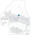 | 2,864 × 3,239 (2.05 MB) | BCMystery (talk | contribs) | Map of Barlow County |
You cannot overwrite this file.
File usage
The following page uses this file: